


We develop deep learning models for monitoring and prediction of objects, hazard risks and streamlining aerial surveys.
Earth observation sensors provide vast amounts of data. Our planet is covered by observations from satellites, airplanes, helicopters, and unmanned aircrafts like drones, providing details down to the centimetre scale.
Exploiting this data has great potential for critical applications like environmental monitoring, situational awareness, and mapping illegal vessel activities, which are of key importance to our user partners.
Our deep learning research within the earth observation domain contributes to new innovative solutions for the mentioned purposes, including approaches for:
This method enables more photo-realistic imagery when analyzing such imagery, paving the way for more precise analysis of satellite imagery for downstream applications.
This approach, dubbed YOLOF, represents an efficient and promising pipeline for identifying vessels at sea.
This method automatically segments oil spills in real-life scenarios, which could lead to faster detection of environmental hazards in the ocean.
Closely related to our work on oil spills, this method relies on computing distances to oil spills, representing novel methodology that can help reduce the number of missed spills.
This method uses explainability (XAI) techniques like gradient saliency maps to reduce the IceNet’s – the state-of-the-art sea ice forecasting model – input features. The work highlights XAI’s potential in refining deep learning models and offers insights for broader applications in climate research and beyond. Read more.
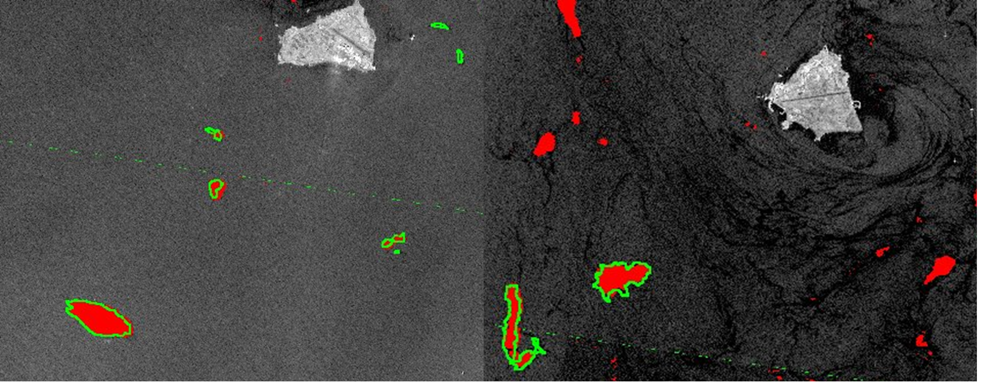
Limited and incomplete training data is a general problem in remote sensing. Combinations of multi-sensor data, such as from optical and radar sensors, and time dependencies is another key challenges. The mentioned methods address these challenges in different ways.
For instance, our oil spill detection method is a step towards quantifying deep learning models’ uncertainty when analyzing remote sensing data. Our method for improving the efficiacy of the IceNet model incorporates explainability techniques that offer invaluable information about the model’s performance and predictions.

As for all image analysis applications, the development of deep learning methodology to solve certain tasks in earth observation often benefits from solutions developed to solve other problems. For instance, when developing methods for building segmentation, ideas from segmentation of oil spills can potentially be transferred.
It can also be valuable to reveal any different behaviour of segmentation algorithms due to different properties in data sources. Aerial imagery and satellite imagery come with different resolution, contrast, noise properties, and by contrasting seemingly similar deep learning methods, the influence of different data properties may be revealed and better understood.
We have developed new methods and obtained insights into how one can use self-supervised learning when there are images acquired at two or more times available, both as a pre-training step and as an integral part of change detection. The insights and experience gained here on the concept of self-supervised learning in general has a wide range of other relevant applications. We have explored similar methodology within seismic analysis, where it has been utilized to identify and characterize geological regions in vast seismic datasets.
.png)
By authors:
Jensen, Are Charles
Published in:
Proceedings of Machine Learning Research (PMLR) ISSN 2640-3498. 233, p. 97–103
on
January 8, 2024
By authors:
Domben, Erik Seip; Sharma, Puneet; Mann, Ingrid
Published in:
Remote Sensing 2023 ;Volum 15.(17) Suppl. 4291. s.1-23
on
August 31, 2023
By authors:
Khachatrian, Eduard; Dierking, Wolfgang; Chlaily, Saloua; Eltoft, Torbjørn; Dinessen, Frode; Hughes, Nick; Marinoni, Andrea.
Published in:
Geophysical Research Letters 2023 ;Volum 50.(4) s.1-7
on
February 14, 2023
By authors:
Qinghui Liu, Michael Kampffmeyer, Robert Jenssen, Arnt-Børre Salberg
Published in:
International Journal of Remote Sensing, 2022
on
July 1, 2022
By authors:
Qinghui Liu (Brian), Michael Kampffmeyer, Robert Jenssen, Arnt-Børre Salberg
Published in:
International Journal of Remote Sensing
on
June 16, 2021